Eagle Creek Public Access Maps
Where in Zionsville Do I Access Eagle Creek?
We are lucky to have an amazing resource like Eagle Creek right in the heart of Zionsville.
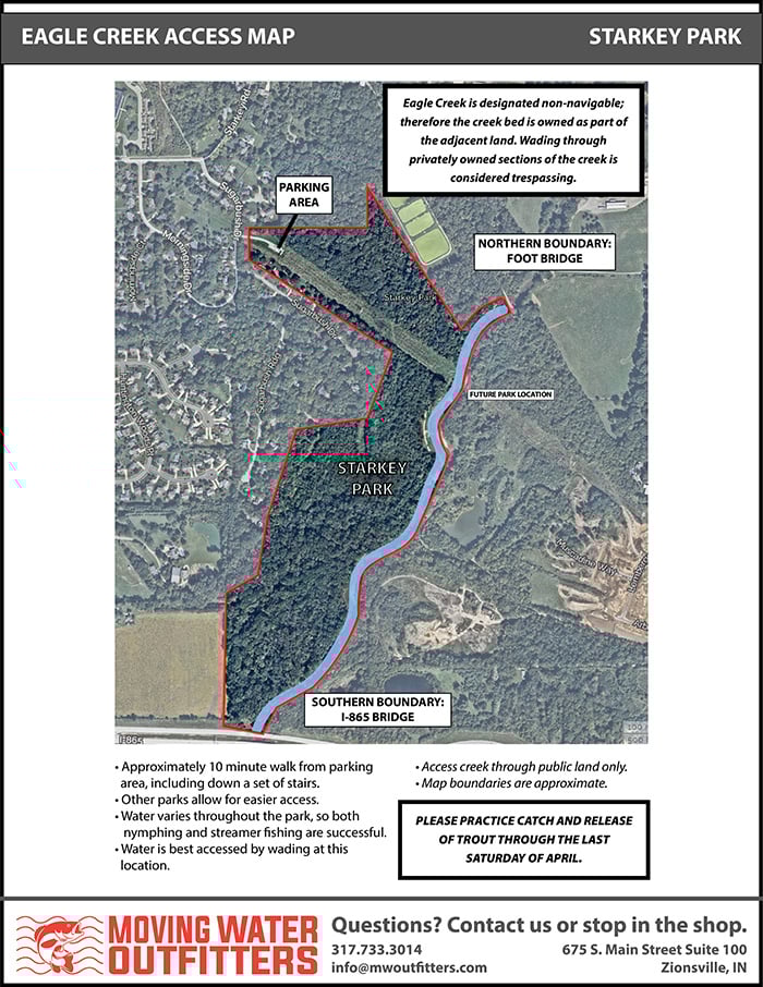
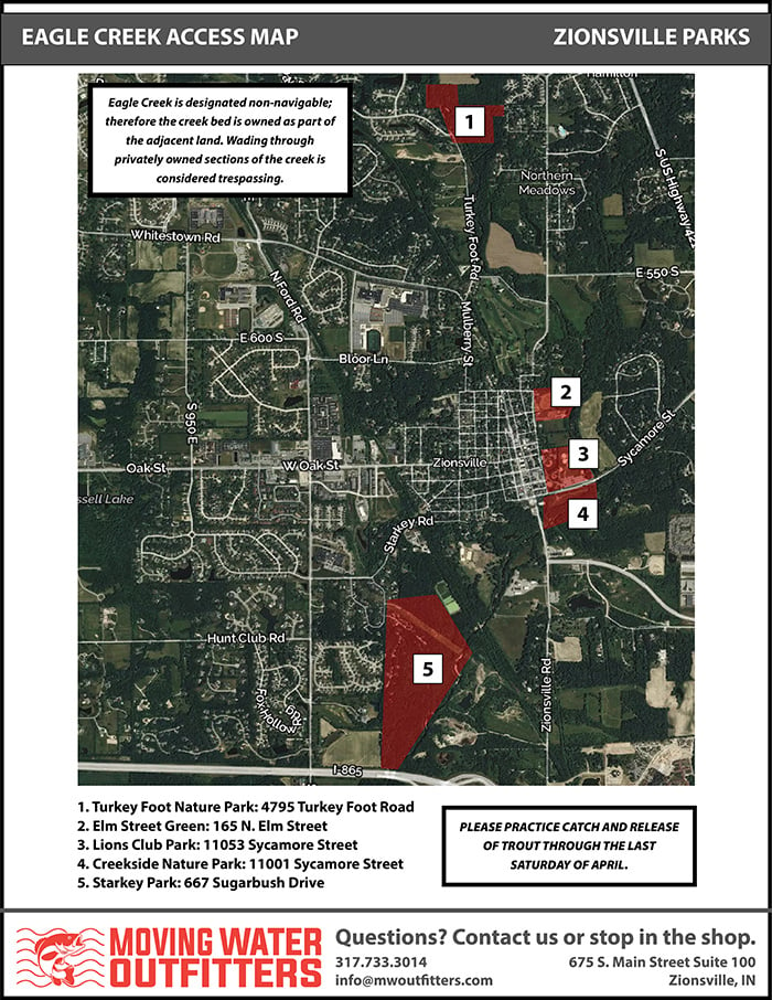
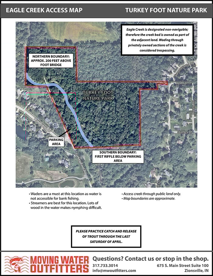
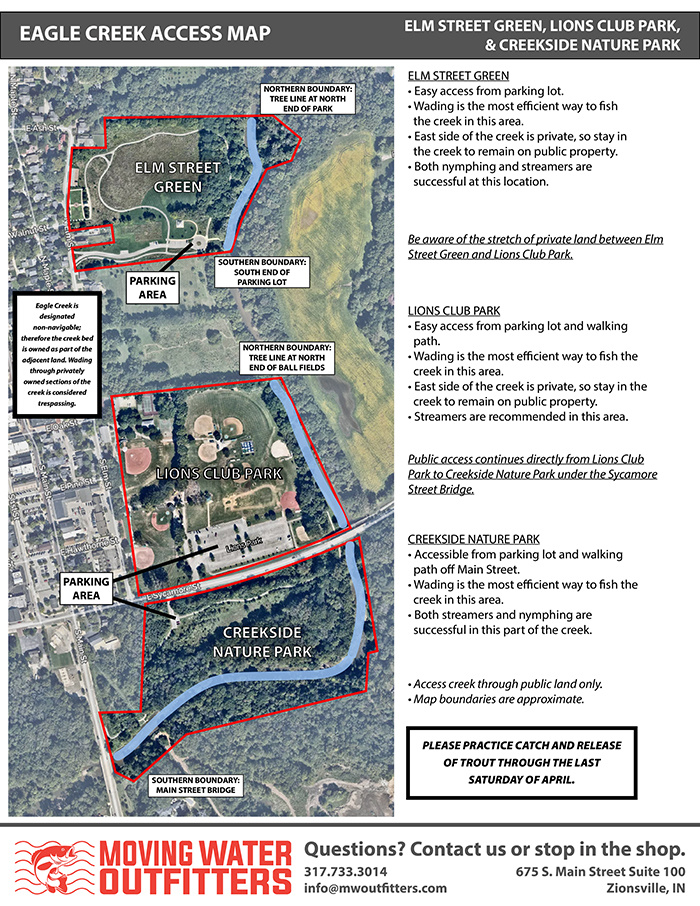
As Eagle Creek is designated as a non-navigable waterway, the creek bed is owned with the adjacent land. Because of this, wading through privately owned sections of the creek is considered trespassing. These maps help provide details on which parts of Eagle Creek are public land, and therefore open for public access. As long as you stay in these areas, you are good to go! Just make sure you have your fishing license and trout stamp if you are targeting that species.
Please note that the boundaries on this map are approximate, so we recommend erring on the side of caution when approaching the private/public limits.
When fishing Eagle Creek - An Indiana Fishing License and Trout stamp (if fishing for trout) is required. These can be obtained through the Indiana DNR Website: Indiana Fish & Wildlife Online License System
Questions? Give us a call at the shop, or stop in. We love to see photos and hear stories of your success on the creek. If you aren't having luck, we are happy to make recommendations on what we find to work well in the creek.
675 S Main Street Suite 100
317.733.3014
Click on any map below for a larger file that can be saved for future reference.
Eagle Creek Access Maps - Overview of Park System
Eagle Creek Access Maps - Turkey Foot Nature Park
Eagle Creek Access Maps - Elm Street Green, Lions Club Park, and Creekside Nature Park
Eagle Creek Access Maps - Starkey Park